
Online Sailing Simulator
Sail a yacht, a dinghy or an AC75 in today's real wind
A free online sailing simulator that runs in your browser. Hoist the sails, ease and trim the main and the jib, tack, gybe, reef and fly a spinnaker in the real wind and weather of the Gulf of Riga — on two cruising yachts, a catamaran, an ILCA 7 and an Optimist dinghy, a 17th-century Dutch yacht and an AC75 foiler — with radar, AIS, a chart and real ships around you.
Free, no account needed. Opens ELEONORA, a 9.1 m sailing yacht, off the mouth of the Daugava near Riga; the crew hoists the sails as soon as she is ready.
Real wind, real weather, real sky
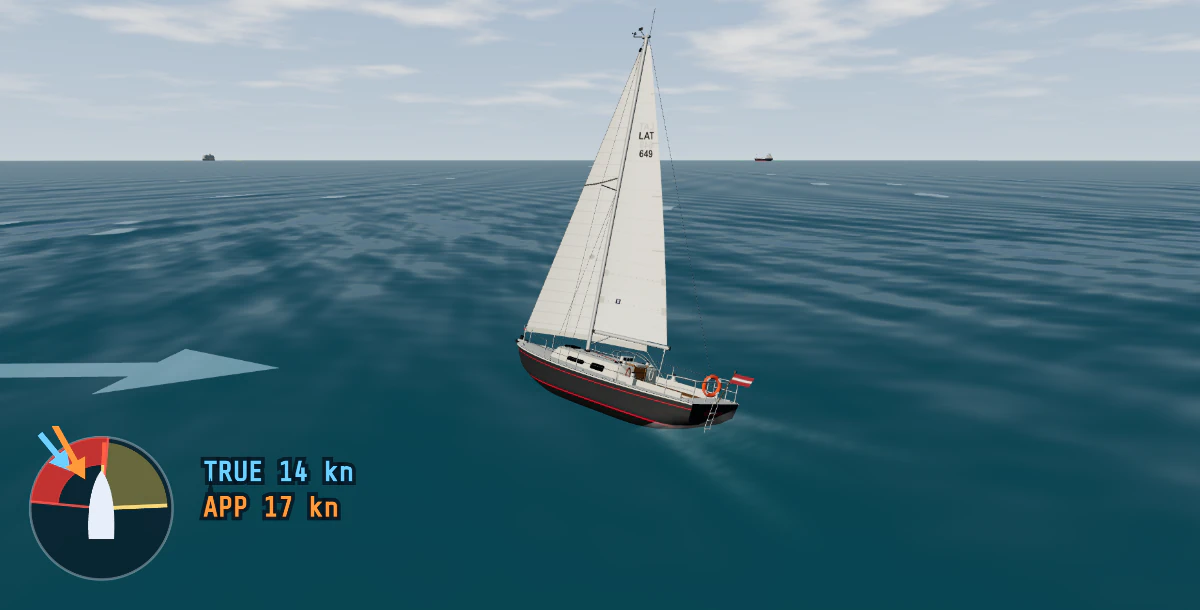
The wind is not a slider. It is the MET Norway forecast for the Gulf of Riga, hour by hour: direction, mean speed and gusts, interpolated between the hours so every visitor in the area sails in the same breeze. The gusts are sized from the forecast's gusts, and the wind veers and backs a few degrees as it goes. A light-air morning, a fresh south-westerly afternoon and a winter gale are all there if you sail at the right time.
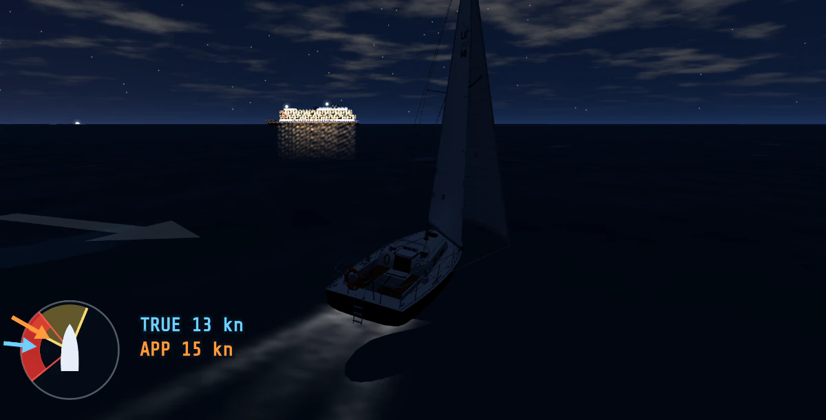
The sea is built from that wind: the waves grow with the stretch of open water the wind has blown over, with its depth and with how long it has been blowing, so a fresh breeze takes hours to raise its full sea and the shallows give a short, steep chop. The sky is real too: the sun and moon stand where they really are, the stars come out after dusk, and cloud, rain, sleet, snow and fog come from the same forecast, with the visibility they leave. Want to see it in daylight at midnight? The DAY / NIGHT button shows the other look.
Sail trim and manoeuvres
HOIST SAILS and the engine stops; she sails. The wind dial in the 3-D view shows the true and the apparent wind and the red no-go zone: point too high and the sails flog and she stops. The sailing boats share these controls, each showing only what she has:
- MAIN and JIB — EASE / TRIM. Ease a sail until its luff starts to flog, then trim it until it stops; the panel shows how far out each one is. AUTO TRIM hands the sheets to the crew, who keep the sails drawing while you steer.
- TACK and GYBE (T, G). The crew handles the sheets; in a gybe the main is sheeted in so the boom crosses under control. Let her speed drop too far before a tack and she ends up in irons.
- REEF: less sail, less heel. As the breeze builds she heels and gets weather helm; reefed she stands up and is easier to steer.
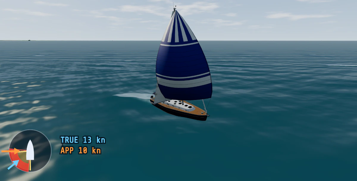
- SPINNAKER (S, on ELEONORA and LATEKO): hoisted off the wind, from 95° of true wind, the genoa rolled away while it is up. Closer than 90° it collapses. In a fresh breeze on a reach she can broach: a warning comes up with the kite flying in about 17 knots of wind or more, and goes red once she is heeled past 25°.
- GOOSE-WING (W): the genoa poled out to windward, opposite the main, for a dead run (true wind 145° or more).
The numbers behave like a real boat. In 12 knots of wind ELEONORA makes about 4.7 knots close-hauled and 6.2 on a beam reach, and her best course to windward is about 44° off the true wind; LATEKO, a bigger boat, makes about 8 knots on a reach.
The boats: from an Optimist to an AC75
Seven of the boats in Free Mode have sails, and each one sails differently:
| Boat | Size | How she sails |
|---|---|---|
| Optimist dinghy | 2.3 m | Stiff and slow, never much over 4 knots; ships water in a breeze, so bail |
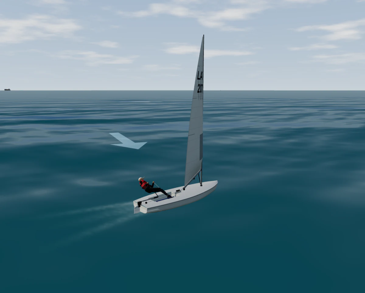
| ILCA 7 dinghy (Laser class) | 4.2 m | You are the ballast: hike out, raise the daggerboard off the wind, plane on a reach; hold the sheet in a gust and she capsizes |
| Sailing yacht ELEONORA (Albin Ballad 30) | 9.1 m | Tiller steering, forgiving; spinnaker and goose-wing; a good first boat |
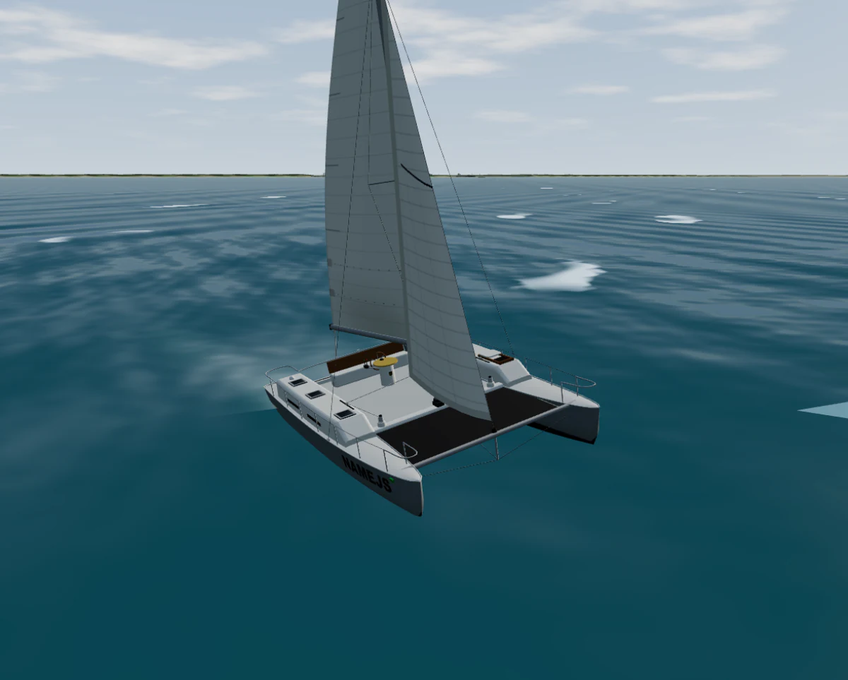
| Sailing catamaran Namejs | 10.5 × 7.0 m | Flat and fast, about 10 knots on a reach in 12 knots of wind; she does not heel to warn you — the windward hull lifts |
| Sailing yacht LATEKO (Beneteau 50) | 15.5 m | Twin wheels, a 150 m² spinnaker; overpressed, her spade rudder loses its grip and she rounds up |
| Libava, 17th-century Dutch yacht replica | 18.6 m | Gaff main, square topsail, staysail and jib; points no higher than about 60°, slow tacks that can fail in a chop |
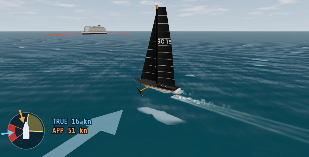
| AC75 foiler (America's Cup class) | 20.7 m | Takes off at about 16–19 knots of boat speed, then flies at 30–50 knots; the bear-away at speed is where she nosedives |
The same sea also has motor boats, from a jet ski and a 5 m motorboat to a 15 m motor yacht, the 25.5 m Pershing 8X and the 40 m B.Yond 40M, even the 183 m product tanker and the 260 m cruise ship, and a sea kayak, if you want to see the other side of the rules of the road.
Dinghies: hike, board and right her
In the ILCA 7 and the Optimist the sailor holds her up. HIKE IN / HALF / FULL (H) as the breeze builds, the daggerboard DOWN / HALF / UP (B), and ease the sheet first in a gust. Run dead downwind with the board up and she can death-roll. Capsized? RIGHT THE BOAT (R): the sailor swims round, stands on the daggerboard and pulls her up, which takes half a minute to a minute.
The catamaran and the foiler
Namejs sails flat on two hulls until the windward one lifts. When WINDWARD HULL FLYING shows, ease the sheets or bear away at once; past that she goes over, and a capsized catamaran stays upside down. The AC75 has no keel and no engine: foils down, bear away to a beam reach and let her build speed until she lifts. Her foils work on AUTO, or by hand (F swaps them, I / K set the ride height); in harbour her chase boat tows her.
Navigation and the rules at sea
This is the sailing side of a bridge simulator, so you are never alone out there. The radar shows the coast and the ships, with AIS targets and ARPA-style CPA and TCPA for each; the chart (OpenSeaMap) follows you with your track, and the DEPTHS layer shades the water, draws the 2, 5, 10 and 20 m contours and turns red where there is less water than your keel needs. Put in a ROUTE and the autopilot can TRACK it.
- Traffic. Container ships, bulk carriers, ro-ros and fishing boats, and always a 183 m product tanker and a 260 m cruise ship in sight (at the start, in the fairway off Riga). In the port of Riga the simulator calls out the speed limits and warns you if you cross too close ahead of a ship.
- Lights and buoys. 230 buoys, beacons and lights from OpenStreetMap, lit at night with their real characters, and leading lines on the chart with the bearing to steer. Your own navigation lights come on at sunset.
- The rules under sail. Port tack gives way to starboard, windward to leeward, and a sailing boat must not impede a ship that can navigate safely only within a narrow channel or fairway (Rule 9). Drill the situations themselves in the COLREG scenarios: Rule 12 — sailing vs sailing, power-driven vs sailing (Rule 18) and a sailing vessel's lights (Rule 25).
The Gulf of Riga: 108 harbours to sail to
The sea is the real Gulf of Riga between Latvia and Estonia: coastline, rivers, harbours and seamarks from OpenStreetMap and depths from EMODnet. Free Mode starts off the mouth of the Daugava near Riga, heading for the island of Ruhnu, about 47 nautical miles to the north-north-west. From there you can sail to Pärnu, Kuressaare, Kihnu, Roja, Salacgrīva or back to the Riga marinas — 108 harbours in all. Speed the clock up ×10 or ×100 for a passage, and if it goes wrong, ↶ 1 H BACK puts you back where you were an hour of sailing ago.
Arriving is a skill of its own. In any harbour, ⚓ DOCK switches to a top view of the marina with fenders and mooring lines: see the boat docking & berthing simulator.
Sailing with others: the shared sea
Log in with a free account and keep SHARED SEA on: you see the other logged-in skippers in Free Mode in the same sea area, and they see you. They see only your boat's name, home port and flag (you choose them) and her position, sails and heel — never your account. Everyone sails in the same wind on the same clock, so time stays at ×1 in the shared sea, and the rules of the road apply between you too. Create a free account.
How it works
- Start. Start sailing opens the simulator in Free Mode with ELEONORA off the Daugava, and the sails go up. Or open the bridge simulator, choose 1. Familiarisation — Free Mode and pick a VESSEL (and an AREA) above the chart.
- The view. The 3-D view starts in CHASE, just behind her. Drag to go round her or higher, zoom with the wheel; the view button switches to BRIDGE (from her helm) or TOP. ⛶ FULL fills the screen.
- Sail. Steer by hand or set the autopilot, ease and trim, tack and gybe. The radar and chart beside the view show where you are and who else is out.
- Mistakes are cheap. Aground, capsized, nosedived? ↶ 1 H BACK, or RESTART.
| Control | Keyboard | Touch / mouse |
|---|---|---|
| Steer | ← → or A D, M midships | ◀ ▶, MID |
| Autopilot (set course) | P on / off | AUTO, −10° −1° +1° +10° |
| Sails, engine | — | HOIST SAILS / DROP SAILS, STOP ENGINE / START ENGINE |
| Sheets | Dinghies: ↑ ↓ the mainsheet | MAIN and JIB: EASE / TRIM; AUTO TRIM |
| Tack / gybe | T / G | TACK / GYBE |
| Spinnaker / goose-wing | S / W | HOIST SPINNAKER / GOOSE-WING |
| Reef | — | REEF |
| Dinghy: hike, board, right her | H, B, R (Optimist: X bail) | HIKE, BOARD, RIGHT THE BOAT, BAIL |
| One hour back | U | ↶ 1 H BACK |
Free — and what a subscription adds
Sailing is part of Free Mode and free for everyone, with no account. If you want more from the same simulator, a Marine Simulator Training plan unlocks all 54 COLREG collision-avoidance scenarios on the radar and AIS bridge display and the full VHF/DSC radio simulator, for a fixed term with no auto-renewal.
Going on charter? Many charter companies also ask the skipper for a VHF radio operator's certificate. If you do not have one yet, our online VHF SRC course takes you through theory, a radio simulator and the exam to the SkipperCheck SRC certificate. Check with your charter company which radio certificate they accept.
Frequently asked questions
Is the sailing simulator free?
Yes. Sailing is part of the simulator's Free Mode, which is free for everyone: every boat, the whole Gulf of Riga and the real wind, in your browser, with no account needed. Only the shared sea, where you see other skippers' boats, asks you to log in with a free account. A paid Marine Simulator Training plan unlocks all 54 COLREG collision-avoidance scenarios and the full VHF/DSC radio simulator; sailing itself costs nothing.
Do I need to install anything? Does it work on a phone or tablet?
Nothing to install: it runs in any modern browser that supports WebGL 3-D graphics. On a computer you can sail with the keyboard shortcuts or the mouse; on a phone or tablet the helm, the sails and the sheets are touch buttons on the helm panel, and FULL makes the simulator fill the screen.
Can I learn to sail with a simulator?
It cannot give you the feel of a tiller, the heel of a real deck or replace time on the water with an instructor. What it does well is the thinking: the points of sail and the no-go zone, when to ease and when to trim, the sequence of a tack and a gybe, when to reef, and the rules of the road with real ships around you, repeated as often as you like in wind that is really blowing today. Combine it with a sailing course or a check-out on a real boat.
Where does the wind come from?
From the MET Norway weather forecast for the Gulf of Riga, hour by hour: direction, mean speed and gusts, plus cloud, rain, snow, fog and the air temperature. The simulator interpolates between the hours, so every visitor in the area sails in the same wind, and it builds the waves from that wind, the open water it blows over and the depth. If the forecast cannot be loaded, it makes up a moderate breeze of its own.
Which boats can I sail?
Seven boats have sails: the cruising yachts ELEONORA (an Albin Ballad 30, 9.1 m) and LATEKO (a Beneteau 50, 15.5 m), the 10.5 m sailing catamaran Namejs, an ILCA 7 (Laser class) and an Optimist dinghy, Libava, a replica of a 17th-century Dutch yacht, and an AC75 foiler of the America's Cup class. In the same sea you can also drive power-driven boats and ships, from a jet ski to the 260 m cruise ship, or paddle a sea kayak.
Can I sail with friends?
Yes, in the shared sea. Log in with a free SkipperCheck account, open Free Mode and you see the other logged-in skippers in the same sea area, with the name, home port and flag they gave their boats. Everyone sails in the same wind on the same clock, so time stays at ×1 while you are in it.
Can I use it to plan a real passage in the Gulf of Riga?
No. The coastline, harbours and seamarks come from OpenStreetMap and the depths from EMODnet, so the sea is real and close to the chart, but it is a training simulator, not a navigation product. For a real passage use official charts, the light list and the latest notices to mariners.
The wind is blowing on the Gulf of Riga right now
ELEONORA is waiting off the Daugava with her sails ready to go up. Free, in your browser.
Related
- Boat docking & berthing simulator — fenders, bow, stern and spring lines in 108 real harbours.
- ARPA · AIS · COLREG bridge simulator — Free Mode, the 3-D bridge view and the collision-avoidance scenarios.
- IALA buoyage: cardinal and lateral marks — the buoys you meet off Riga, by day and by night.
- How to prepare for a sailing charter — documents, VHF radio, the boat briefing and pre-departure checks.
Screenshots from the simulator. Coastline, harbours and seamarks © OpenStreetMap contributors (ODbL); depths © EMODnet Bathymetry Consortium (CC BY 4.0); wind and weather: MET Norway forecast.